| Return to Homepage |
|
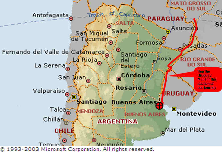
We entered Argentina at Iguazu Falls and continued south. The route took us down the thin peninsula of land belonging to Argentina that lies between Paraguay and Brazil. Initially we kept to the west close to Paraguay before heading more south-easterly at the town of Posadas. Once we were close to the Brazilian border again, traffic increased and the road shoulders that had initially made life in Argentina more pleasant disappeared. After many close shaves with trucks we sat down and studied our maps for alternative routes. We spoke to some motorcyclists in a service station who advised us that Uruguay's roads are very bad and slow. They thought we should stay in Argentina for this reason but the idea of potholed roads which trucks might avoid gave us hope of more tranquil cycling. With this thought in mind we made a decision to head back into Brazil crossing the border and headed through the Brazilian border smuggler's city of Uruguaiana so as to pick up a road heading south into Uruguay. This turned out to be an excellent decision with the roads far exceeding our expectations. The Country had a friendly and safe atmosphere which helped in allowing us to cycle into the night and camp by the roadside with little difficulty.
We re-entered Argentina close to Buenos Aires by ferry across the Rio de La Plata from Colonia making our final cycle ride to the centre of Buenos Aires and arriving at the Obelisk in Buenos Aires in the late evening.
| Return to Homepage |